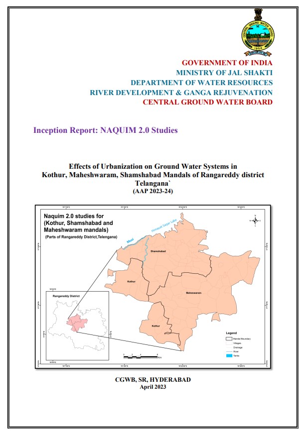
Inception Report: NAQUIM 2.0 Studies Effects of Urbanization on Ground Water Systems in Kothur, Maheshwaram, Shamshabad Mandals of Rangareddy district Telangana
| Category |
Aquifer Mapping |
| State |
Telangana
|
| District |
Hyderabad Ranga Reddy |
| Block |
Abdullapurmet Amangal Amberpet Ameerpet Asifnagar Bahadurpura Balapur Bandlaguda Charminar Chevella Farooqnagar Gandipet Golconda Hayathnagar Himayathnagar Ibrahimpatnam Jilled Chowdergudem Kadthal Kandukur Keshampeta Khairthabad Kondurg Kothur Madgul Maheshwaram Manchal Marredpally Moinabad Musheerabad Nampally Nandigama Rajendranagar Saidabad Saroornagar Secunderabad Serilingampally Shabad Shaikpet Shamshabad Shankarpally Talakondapalle Tirumalagiry Yacharam |
| Year of Issue |
2023 |
| Number of Authors |
1 |
| Name of Authors |
Ms. Rani V. R. |
| Keywords |
NAQUIM 2.0, Inception Report, Kothur, Maheshwaram, Artificial Recharge Plan, Ground Water Quality, Aquifer Management Plan, CGWB, Urbanization, Telangana |
| File |
Download |
The AAP 2023-24, an area of 556 sq. km. covering 85 villages of three mandals namely Kothur, Maheshwaram and Shamshabad of Rangareddy district in Telangana State has been selected based on the priority areas identified under NAQUIM 2.0. The area falls on SOI toposheets No. 56/K/8 1:50,000 scale. The study area is bordered by Hyderabad and Medchal-malkajgiri district in the north and Mahabubnagar district in the south. The eastern and western parts are bordered by mandals of Rangareddy district. The study area falls in Musi drainage basin and is drained by Musi River, a tributary of Krishna River, which flows in almost E-W direction and possess two main lakes - Osman Sagar and Himayat Sagar. The drainage system in the area is sub-dendritic to rectangular type indicating poor permeability of the soils/formations. Almost all the tanks were disappeared due to increasing urbanization. Area is shallow to moderately weathered pediplain gently undulating and is gently sloping area with isolated hills.