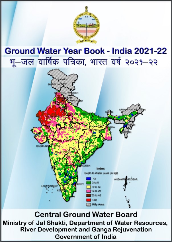
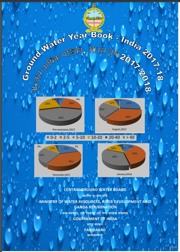
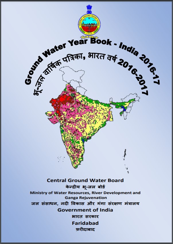
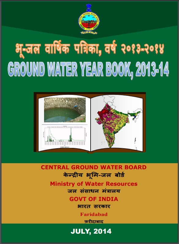
CGWB - Publications Warehouse

Media image
Publication
AQUIFER MAPPING AND MANAGEMENT OF GROUND WATER RESOURCES Khargone District Madhya Pradesh

Aquifer mapping is a multi-disciplinary scientific approach for aquifer characterization or it can be defined as a scientific process, wherein a combination of geologic, geoph...

Media image
Publication
AQUIFER MAPPING AND MANAGEMENT OF GROUND WATER RESOURCES Mandla District Madhya Pradesh

National project on Aquifer Mapping (NAQUIM) is a programme being carried out by Central Ground Water Board for mapping and documentation of aquifers, their characteristics, i...

Media image
Publication
AQUIFER MAPPING AND MANAGEMENT OF GROUND WATER RESOURCES GANDHINAGAR DISTRICT GUJARAT

Gandhinagar District is an administrative division of Gujarat, India, whose headquarters are at Gandhinagar, the state capital. It was organized in 1964. According to 2011 Cen...

Media image
Publication
AQUIFER MAPPING AND MANAGEMENT OF GROUND WATER RESOURCES BOTAD DISTRICT GUJARAT

Botad was created on 15 August 2013 from the southwestern part of Ahmedabad District(Barwala and Ranpur blocks) and the north-western part of Bhavnagar District (Botad and G...

Media image
Publication
AQUIFER MAPPING AND MANAGEMENT OF GROUND WATER RESOURCES CHANDRAPUR DISTRICT MAHARASHTRA

National Aquifer Mapping (NAQUIM) has been taken up in XII five-year plan by CGWB to carry out detailed hydrogeological investigation on 1:50,000 scale. Chandrapur district is...

Media image
Publication
AQUIFER MAPPING AND MANAGEMENT OF GROUND WATER RESOURCES JAMNAGAR DISTRICT GUJARAT

The district has a geographical area of 6027 sq. km. The district comprises of six blocks viz Jamnagar, Dhrol, Jodiya, Jamjodhpur, Lalpur Kalavad. The stage of groundwater ex...

Media image
Publication
AQUIFER MAPPING AND MANAGEMENT OF GROUND WATER RESOURCES DEVBHUMI DWARKA GUJARAT

The total population of the district is 7,52,484 of which male population constitutes about 3,86,566 (51.37%) and female population is 3,65,918 (48.63 %) (Census, 2011) while...

Media image
Publication
AQUIFER MAPPING AND MANAGEMENT OF GROUND WATER RESOURCES NEEMUCH DISTRICT MADHYA PRADESH

Aquifer mapping is a multidisciplinary and a holistic scientific approach wherein a combination of geologic, geophysical, hydrologic and chemical analysis is applied to charac...

Media image
Publication
AQUIFER MAPPING AND MANAGEMENT OF GROUND WATER RESOURCES RAISEN DISTRICT MADHYA PRADESH

Project on National Aquifer Mapping (NAQUIM) aims the mapping of aquifers, estimation of available groundwater resources and preparation of proper management plan for sustaina...

Media image
Publication
AQUIFER MAPPING AND MANAGEMENT OF GROUND WATER RESOURCES VIDISHA DISTRICT MADHYA PRADESH

Central Ground Water Board has pioneered extensive groundwater studies, in all the hydrogeological terrain of the country. It has remarkably brought out comprehensive regional...

Media image
Publication
AQUIFER MAPPING AND MANAGEMENT OF GROUND WATER RESOURCES MANDSAUR DISTRICT MADHYA PRADESH

Mandsaur district is located on northwest part of Madhya Pradesh state. It is one of the important tribal district of Malwa regions of Madhya Pradesh. The district is bounded...

Media image
Publication
AQUIFER MAPPING AND MANAGEMENT OF GROUND WATER RESOURCES SURENDRANAGAR DISTRICT GUJARAT

Surendranagar district is located in the north eastern part of Saurashtra Peninsula of Gujarat State. The district covers an area of around 9225 Sq. Km. A major portion of th...