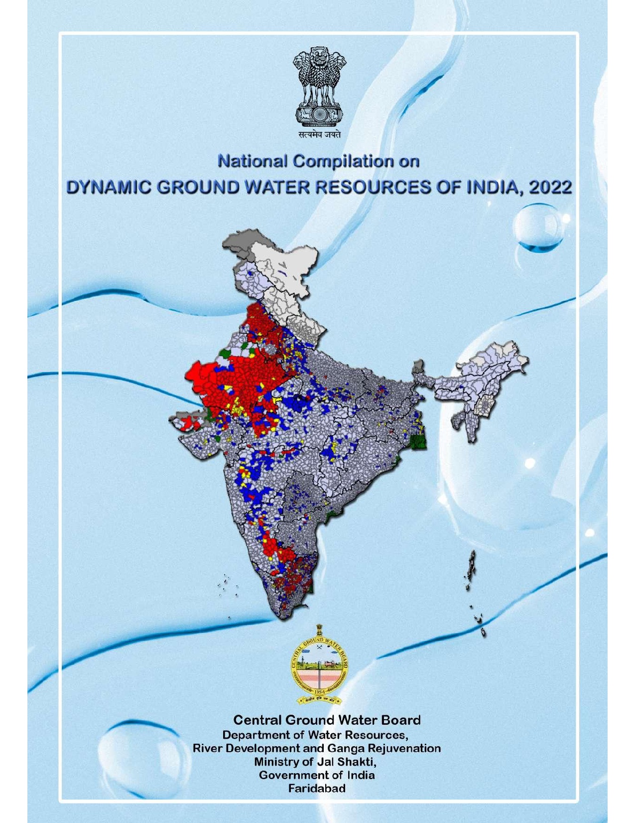
CGWB - Publications Warehouse

Media image
Publication
AQUIFER MAPPING AND GROUND WATER MANAGEMENT JAISALMER DISTRICT, RAJASTHAN

AQUIFER MAPPING AND GROUND WATER MANAGEMENT JAISALMER DISTRICT, RAJASTHAN

Media image
Publication
AQUIFER MAPPING AND MANAGEMENT PLAN Hangal Taluk, Haveri District, Karnataka

Aquifer mapping studies have been carried out in Hangal taluk, Haveri district of Karnataka, covering an area of 770 sq.kms under National Aquifer Mapping Project. The Hangal...

Media image
Publication
AQUIFER MAPPING AND GROUND WATER MANAGEMENT JAIPUR DISTRICT, RAJASTHAN

AQUIFER MAPPING AND GROUND WATER MANAGEMENT JAIPUR DISTRICT, RAJASTHAN

Media image
Publication
AQUIFER MAPPING AND MANAGEMENT PLAN OF BAILAHONGAL TALUK, BELAGAVI DISTRICT, KARNATAKA STATE

Aquifer Mapping Studies have been carried out in Bailhongal taluk, Belagavi district of Karnataka, covering an area of 1120 sq.kms under National Aquifer Mapping Project. The...

Media image
Publication
AQUIFER MAPPING AND GROUND WATER MANAGEMENT DISTRICT BARAN, RAJASTHAN

Baran District was covered out of east whole Kota district of Rajasthan state on 10th April, 1991 through Government order dated 31st March, 1991. The district is named after...

Media image
Publication
AQUIFER MAPPING AND MANAGEMENT OF GROUND WATER RESOURCE HAVERI TALUK, HAVERI DIST, KARNATAKA

Aquifer mapping studies were carried out in Haveri taluk, Haveri district of Karnataka, covering an area of 800 sq.kms under National Aquifer Mapping Project. Haveri taluk o...

Media image
Publication
Manual Ground Water Exploration Concepts and Guidelines 2003

Manual Ground Water Exploration Concepts and Guidelines 2003

Media image
Publication
Manual on Evaluation of Aquifer Parameters 1997

Manual on Evaluation of Aquifer Parameters 1997

Media image
Publication
AQUIFER MAPPING AND MANAGEMENT PLAN

AQUIFER MAPPING AND MANAGEMENT PLAN Bagepalli Taluk, Chikballapur District,Karnataka

Media image
Publication
Aquifer Mapping and Managment Plan Hirekerur Taluk, Haveri Dist_report Karnataka

Aquifer mapping studies were carried out in Hirekerur taluk, Haveri district of Karnataka, covering an area of 807 sq.kms under National Aquifer Mapping Project. Hirekerur tal...

Media image
Publication
AQUIFER MAPPING AND MANAGEMENT PLAN OF GROUND WATER RESOURCES CHIKKODI TALUK, BELAGAVI DISTRICT, KARNATAKA

Aquifer mapping studies have been carried out in Chikkodi Taluk, Belagavi district of Karnataka, covering an area of 1269 sq.kms under National Aquifer Mapping Project. Chikko...

Media image
Publication
AQUIFER MAPPING AND MANAGEMENT PLAN Ranebennur Taluk, Haveri District,Karnataka

Aquifer mapping studies have been carried out in Ranebennur taluk, Haveri district of Karnataka, covering an area of 901 sq. kms under National Aquifer Mapping Project. Raneb...