CGWB - Publications Warehouse

Media image
Publication
AQUIFER MAPPING AND MANAGEMENT OF GROUND WATER RESOURCES BHADRAK DISTRICT, ODISHA

HYDROGEOLOGICAL FRAMEWWORK, GROUNDWATER DEVELOPMENT PROSPECTS AQUIFER MANAGEMENT PLAMN OF BHADRAKH DISTRICT, ODISHA

Media image
Publication
Bhujal Samvad Vol 20-21 (Jan-JUne 2023)

Bhujal Samvad Vol 20-21 (Jan-JUne 2023)

Media image
Publication
AQUIFER MAPPING AND MANAGEMENT PLAN DHENKANAL DISTRICT, ODISHA

The activities under NAQUIM are aimed at identifying the aquifer geometry, aquifer characteristics their yield potential along with the quality of water occurring at various...

Media image
Publication
REPORT ON AQUIFER MAPS AND MANAGEMENT PLAN OF SHEOHAR DISTRICT OF BIHAR

The district of Sheohar, which till the 1991 Census was a part of Sitamarhi district as one of its subdivisions, was elevated to the status of a district on 6th October, 199...

Media image
Publication
Aquifer Mapping and Ground Water Management Plan Sitamarhi District, Bihar

Sitamarhi district, located in the northern part of Bihar State was carved out the old Muzaffarpur in the year 1972. The district is an acclaimed pilgrim centre and boasts o...
Media image
Publication
AQUIFER MAPPING AND MANAGEMENT PLAN GAJAPATI DISTRICT, ODISHA

he NAQUIM study was carried out with the following broad objectives: 1) to define the aquifer geometry with precise lateral and vertical demarcation down to the depth of 200...

Media image
Publication
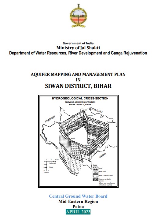
REPORT ON AQUIFER MAPPING AND MANAGEMENT PLAN IN SIWAN DISTRICT, BIHAR (AAP 2022-23)

The study area lies in the Indo-Gangetic Plains of Bihar and forms the western part of the state (Fig.1). It covers a mappable area of 2223 sq.kms. and consists of 19 blocks...

Media image
Publication
HYDROGEOLOGICAL FRAMEWORK, GROUND WATER DEVELOPMENT AQUIFER MANAGEMENT PLAN OF JAGATSINGHPUR DISTRICT, ODISHA STATE

Aquifer Mapping Of Jagatsinghpur District, Odisha 1 1. INTRODUCTION Jagatsinghpur is one of the most natural disaster-prone districts of costal Odisha. The district came i...
Media image
Publication
AQUIFER MAPPING AND MANAGEMENT IN JHARSUGUDA DISTRICT, ODISHA CGWB, SER, BHUBANESWAR 1 AQUIFER MAPPING MANAGEMENT PLAN JHARSUGUDA DISTRICT ODISHA

Jharsuguda district is bounded between the 21° 34’ North and 22°02’ North latitudes and also between 83°25’ East and 84°23’ East longitudes (Fig-1). Prior to 1993, Jharsugud...
Media image
Publication
AQUIFER MAPPING AND MANAGEMENT PLAN IN NAYAGARH DISTRICT, ODISHA

Nayagarh District with an area of 3890 Sq Km lies between 19 degree 54’ to 20 degree 32’ North Latitude and 84 degree 29’ to 85 degree 27’ East Longitude and falls in the Surv...

Media image
Publication
AQUIFER MAPPING AND MANAGEMENT PLAN OF PURI DISTRICT ODISHA

The study area lies between North Latitudes 19° 28 and and 20° 10’ East Longitude 85° 09 and 86° 25 , falling in Survey of India Degree toposheet (1:2,50,000 Scale) numbers...

Media image
Publication
AQUIFER MAPPING AND MANAGEMENT OF GROUND WATER RESOURCES MANCHERIAL DISTRICT, TELANGANA

National Aquifer Mapping (NAQUIM) had been taken up by CGWB to create robust database of hydrogeological information at 1:50,000 scale for sustainable groundwater. Aquifer ma...